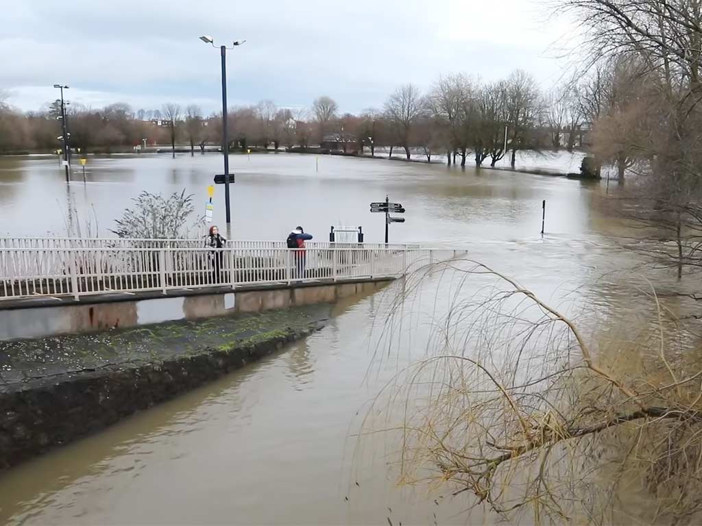
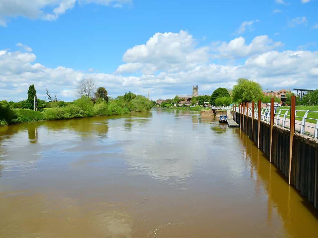
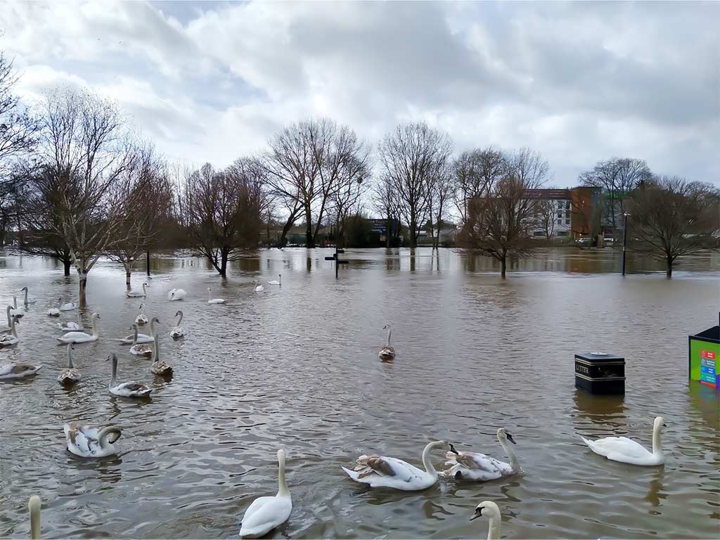
Have you ever wondered why Worcester has been grappling with historic flooding events? Each year, Worcester faces the brunt of flooding due to a combination of factors.
Climate change plays a significant role in exacerbating the frequency and intensity of precipitation events, leading to localized flooding issues that continue to escalate.
When it rains, water cascades off impermeable surfaces like roads, roofs, and sidewalks, gathering pollutants along the way before discharging into storm drains and eventually into rivers and lakes.
Worcester’s flooding woes are further compounded by its historical and current land uses. A substantial portion of the city’s landscape, close to 25%, comprises impermeable surfaces such as roads, parking lots, and building roofs, which overload drainage systems.
Additionally, compacted soils limit the absorption capacity of rainwater, while past industrial and developmental activities in flood-prone areas along rivers and streams have left a lasting impact.
The city’s hilly topography adds to the challenge, creating numerous low-lying areas vulnerable to flooding.
Early Records of Flooding in Worcester

In Worcester, historical records highlight significant flooding events, shaping the city’s resilience strategies. Understanding past floods is crucial for preparing for future challenges and mitigating risks effectively.
The Impact of the 1930s Floods
In the 1930s, Worcester faced devastating floods that reshaped the community’s perception of flood risks. These flood events underscored the urgent need for improved infrastructure and comprehensive disaster response plans.
The lessons learned from the 1930s floods continue to influence modern flood management strategies in Worcester.
Community and Infrastructure Development Post-Floods
Following the destructive floods of the 1930s, Worcester embarked on extensive community and infrastructure development initiatives to enhance resilience against future flooding events.
Investments were made in flood protection systems, sustainable urban planning, and community engagement to create a more flood-resilient city.
The post-flood development efforts reflect Worcester’s commitment to safeguarding its residents and infrastructure from the impact of recurrent floods.
Major Causes of Flooding in Worcester

When exploring the reasons behind flooding in Worcester, it’s crucial to delve into both natural and human-related factors that have contributed to the city’s historical struggle with this issue.
Natural Causes: Weather Patterns and Geographic Factors
- Weather Patterns: Worcester’s susceptibility to flooding is significantly influenced by extreme weather events, such as heavy rainfall or hurricanes.The area’s unique topography and proximity to water bodies amplify the impact of intense precipitation, leading to heightened flood risks during severe weather occurrences.
- Geographic Factors: Worcester’s geographical features, including its hilly terrain and river systems, play a pivotal role in exacerbating flooding events.The convergence of water flow from elevated areas towards lower-lying regions increases the likelihood of flash floods and river overflows, posing challenges for effective flood management strategies.
- Urban Development: The rapid expansion of urban infrastructure in Worcester has altered the city’s landscape, paving the way for increased impervious surfaces like roads and buildings.This urbanization has disrupted natural drainage patterns, limiting the absorption of rainwater into the soil and elevating runoff volumes during storms, leading to heightened flood risks in developed areas.
- Land Use Changes: Shifts in land utilization, such as deforestation or construction activities, have further compounded Worcester’s flood vulnerability.Alterations to natural habitats and ecosystems disrupt the balance of water circulation, impacting floodwater retention capacities and exacerbating the severity of flooding incidents in the region.
Notable Floods in Recent Decades

In recent Worcestershire history, two significant flood events stand out for their impact and devastation.
Analysis of the 1950s Hurricane-related Floods
During the 1950s, Worcester faced a dual onslaught of hurricanes that brought unprecedented rainfall to the region.
Hurricane Connie in August 1955 saturated the ground, raising river and reservoir levels. Just a week later, Hurricane Diane hit, with rainfall totals reaching nearly 20 inches over two days.
The Farmington River recorded record accumulations, causing extensive flooding. The effects of these hurricanes were staggering, leading to massive flooding and significant damage in Worcester and its surroundings.
The 2000s: A Series of Devastating Flood Events
The 2000s saw Worcester grappling with a series of devastating flood events, including the severe flooding in June 2007.
This period marked a challenging time for the city, with heavy rainfall and minor floods impacting Worcestershire and other parts of the country.
The floods in June 2007 were a reminder of Worcester’s vulnerability to extreme weather events and the importance of effective flood mitigation strategies.
Mapping and Mitigation Techniques
Understanding the evolution of flood mapping in Worcester is crucial for effective flood management. Over the years, advancements in technology have enabled more accurate mapping of flood-prone areas in the city.
By identifying high-risk zones, authorities can implement targeted mitigation strategies to reduce the impact of flooding on residents and infrastructure.
Evolution of Flood Mapping in Worcester
In Worcester, the evolution of flood mapping has been driven by the need to enhance preparedness and response to flooding events.
Traditional mapping methods have been complemented by sophisticated modeling techniques that consider various factors influencing flood risks, such as topography, rainfall patterns, and development practices.
These detailed maps provide valuable insights into vulnerable areas, helping urban planners and emergency responders make informed decisions to safeguard the community.
Innovative Techniques for Flood Mitigation and Management
Innovative techniques play a significant role in enhancing flood mitigation and management in Worcester.
From green infrastructure solutions like permeable pavements and green roofs to advanced stormwater management systems, the city is embracing creative approaches to reduce flood risks.
Additionally, the use of nature-based solutions, such as wetland restoration and floodplain preservation, is gaining traction to enhance resilience against extreme weather events.
By combining traditional engineering practices with innovative strategies, Worcester is pioneering sustainable flood mitigation efforts to protect both its residents and environment.
The Future of Flooding in Worcester

As Worcester continues to grapple with the effects of climate change, the future of flooding in the city remains a pressing concern.
Understanding the projections linked to climate change and implementing effective strategies for flood preparedness and resilience are key to safeguarding the community against potential disasters.
Projections: Climate Change and Its Impact
The impacts of climate change are expected to exacerbate flooding issues in Worcester. With an increase in extreme weather events and heavier rainfall due to climate variability, the city faces heightened risks of flooding.
The interplay between urban development, impervious surfaces, and changing land use patterns further amplifies the vulnerability to flooding.
Embracing sustainable practices and adaptive measures is essential to mitigate these risks and enhance Worcester’s resilience against future flood events.
Strategies for Flood Preparedness and Resilience
To tackle the evolving challenges of flooding, Worcester is adopting proactive strategies for flood preparedness and resilience.
Investing in robust infrastructure that can withstand extreme weather conditions, enhancing stormwater management systems, and promoting green infrastructure solutions are integral parts of the city’s flood mitigation efforts.
Through community engagement, early warning systems, and coordinated response plans, Worcester aims to build a resilient framework that can effectively respond to and recover from flooding events.
By integrating nature-based solutions like wetland restoration and sustainable urban planning, Worcester is forging a path towards a more flood-resilient future.
Frequently Asked Questions
Why does Worcester struggle with flooding?
Worcester faces flooding due to impervious surfaces like roads and buildings, leading to excess water runoff taxing drainage systems.
How has Worcester prepared for floods?
Worcester has adapted with flood mapping for targeted mitigation, implementing green infrastructure solutions, and investing in resilient infrastructure projects.
What challenges does Worcester face in the future regarding floods?
Worcester anticipates increased flood risks due to climate change, necessitating sustainable practices, community engagement, and nature-based solutions for resilience.
Are flood events impacting Worcester’s development?
Yes, notable flood events have shaped Worcester’s urban development strategies and resilience efforts against extreme weather and flood risks.
Conclusion
You’ve now gained insights into Worcester’s historical battle with flooding, from the impactful events of the 1930s to present-day challenges.
Understanding the intricate mix of natural and human factors influencing flooding is crucial for developing effective resilience strategies.
Worcester’s evolution in flood mapping and embrace of innovative solutions like green infrastructure showcase a proactive approach to mitigating risks.
As climate change looms, Worcester’s focus on robust infrastructure, stormwater management, and community involvement is key to building a resilient framework.
By staying ahead with sustainable practices and adaptive measures, Worcester is paving the way for a more flood-resilient future.
Jaclyn Lowe